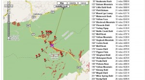
Look out sliced bread, Hey What’s That? will give you a run for your money. That is at least for us outdoor types. What is Hey What’s That? you ask? It’s a mashup of Google Maps, topographic data, and mountain peak names that gives you a 360 degree profile from any predefined point along with the names of the peaks that surround it. If you know the latitude/longitude, you can custom enter the coordinates and it will generate a custom profile for you (It takes a few minutes). The visibility cloak option will shade any areas you can actually see on the Google Map. A very cool Web 2.0 app! Now if I could just get my GPS to do all this for me!
Thanks to the folks over at ModernHiker for the heads up!

