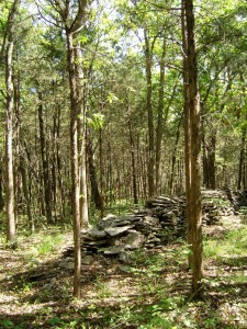
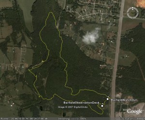
 Headed in a little different direction today for a local hike. Barfield Cresent Park is located in southwestern Murfreesboro (not so far from Casa de Bryan). I went to check it out and I was thoroughly impressed. Most of the city park trails of significant length (save Nashville) have been paved over. Barfield Crescent has its share of paved trails, but there’s a wilderness loop that actually a very nice hike. Of course I realized it would be when I saw the sign thanking the Tennessee Trails Association for its construction.
Wilderness Station Parking Lot
Distance: 3.8 miles
Max Elevation: 813 ft
Total Elevation climb: 412 ft
Trail Type: single track dirt, rocky
Temperature: 70s, sunny and warm, not a cloud in the sky
Time: 1:33 moving, 0:20 resting
Significant Features: birds and trees!
One of the things I liked best about this trail was the ability to add to the distance easily. In for a quick walk, no problem… hike the 2.5 mile inner loop. Up for a longer jaunt in the woods… add any of four approximately 1 mile loops for a longer hike.
One thing to note in my track is there is a nice little side trip over to the top of the cut for U.S. 431. If watching the traffic in Murfreesboro is your thing, this is your trail. I took it by mistake as the trail isn’t well blazed here and I missed a turn.
As typical for the Nashville basin, the views are more of forest and fields then falls and overlooks. Still, a bad day out here beats most days at the office.
Links:
Pictures are HERE
Directions are HERE
Trail Map is HERE
Park website is HERE

Download the Google Earth track