 Around 200 years ago, this was a bustling industrial area. Montgomery Bell, one of Tennessee’s first entrepreneurs, owned iron ore mines and furnaces in the areas of Dickson and Cheatham Counties, Tennessee. Mr. Bell supplied, among other things, cannonballs to Andrew Jackson’s army during the War of 1812. Mr. Bell may have owned a share of the operations in what is now Montgomery Bell State Park
Distance: 6.0 miles, loop trail
Total Elevation Climb: 260 feet, mainly minor ups and downs
Trail type: varies from single track dirt and rock to old road bed to grass along the lake shore
Temperature: upper 40s, sunshine and clear, blue skies
Significant features: mostly forest, a few views into deep hollows, and the lake
As I normally do when I go someplace new, I stopped by the visitors center to get a trail map. There I encountered two problems: the visitors center is closed on weekends during the winter (um, seems like they’d have more traffic on weekends, but I’m sure there’s a logical explanation) and trail maps are not available outside the visitors center. So, I took to the trail with no official map (I did have my GPS and a guide book, 60 Hikes Within 60 Miles: Nashville, which has a very simple map). Now that I look, they don’t even publish a map online.
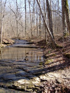
The first couple of miles is just a nice walk in the woods. There’s nothing really strenuous about it. It’s just a really peaceful place. There are a number of stream crossings. As always be careful, but I didn’t even get out my gaiters. At about 1.7 miles, I will encountered a fairly nice backcountry shelter with about 8 bunks. It’s located right at the confluence of the streams and has a fairly nice view. I could just imagine listening to the streams babbling while falling asleep. Of course, its located the ideal distance to backpack in on a late Friday afternoon after work.
After another mile or so, the trail turns onto a gravel service road (still maintained and used) for about 1/4 mile and then onto an old maintenance road that borders the golf course.
About one more mile passes away and the trail turns back onto single track to the lake where I ran into a couple of guys fishing. The lake created by an earthen damn is about 17 acres. By the lake shore, the trail turns to grass, so watch for the signs.
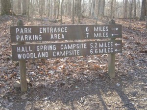
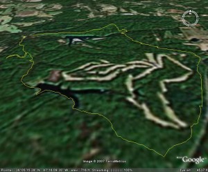
After passing the dam, the trail heads back up into the woods along the hollow and up the hill. Another nice walk in the woods. If you download the Google Earth kmz file, you will find that I backtracked about 1/2 mile. I could have edited it out, but I decided to make a point. This was the sign at the trail junction.
 Remember, I don’t have the detailed map and really didn’t want to get out the guide book. So, I headed for the parking lot. After about 20 minutes, I checked the GPS and decided to look at the guide book. Turns out it would have taken me to a parking lot alright. But it wouldn’t have been the one I parked in. I’ll chalk this one up to my own laziness, but the signage could have been much better. This is a definite nominee for the malfunction junction award.
I did enjoy this hike and am looking forward to day hiking the other half of this trail as well as an overnight trip in the near future.
Pictures are HERE
